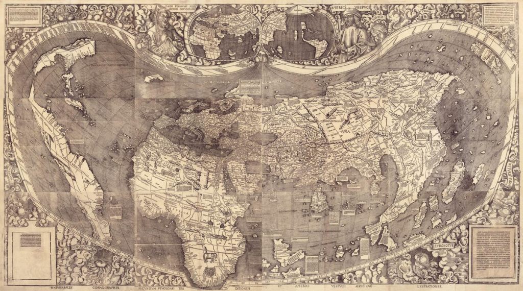
This groundbreaking 16th-century map is known as “America’s birth certificate.”
The Library of Congress’ Thomas Jefferson Building houses the largest collection of maps in the world. Their Geography & Map Division manages over 5.5 million maps, 80,000 atlases (including a significant collection of Ptolemy atlases), 500 globes, reference materials, raised relief models, and a huge digital library.
One of the most notable items is the only surviving copy of Martin Waldseemüller’s world map from 1507. It is the first map to depict the Western Hemisphere as a distinct continent, surrounded by water and not connected to Asia. AtlasObscura.com